Trail Walking Le Bosc - Le Bosc - prieuré de Grandmont - Le Brédou - Soumont - Photo

Le Bosc - prieuré de Grandmont - Le Brédou - Soumont

 vertygo
vertygo

User

© OpenStreetMap contributors
Length
Length
19.1 km
Max alt
Max alt
524 m
Uphill gradient
Uphill gradient
668 m
Km-Effort
Km-Effort  
28 km
Min alt
Min alt
201 m
Downhill gradient
Downhill gradient
667 m
Boucle
Boucle
Yes
Creation date :
2017-03-24 00:00:00.0
Updated on :
2017-03-24 00:00:00.0

(2 Reviews)

Walking
Walking
5h46
Difficulty : Medium

Scan this QR Code to open this trail in the SityTrail application

FREE GPS app for hiking

Logo SityTrail SityTrail

IGN / Geographical institutes

Download SityTrail from the App Store Download SityTrail from Google Play

Logo SityTrail SityTrail World

The world is yours!

Download SityTrail from the App Store Download SityTrail from Google Play Download SityTrail on Huawei AppGallery

About

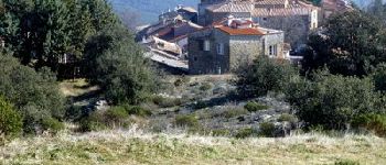
Trail Walking of 19.1 km to be discovered at Occitania, Hérault, Le Bosc. This trail is proposed by vertygo.

Description

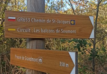
Randonnée inspirée de 2 Rando Fiches Hérault "Lodève - Soumont - Le Brédou" "Soumont - Le Bosc - Grandmont".
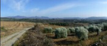
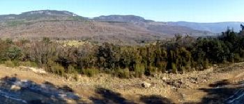
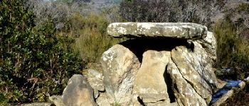
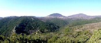
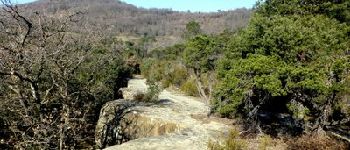
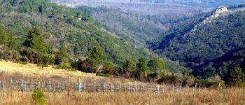
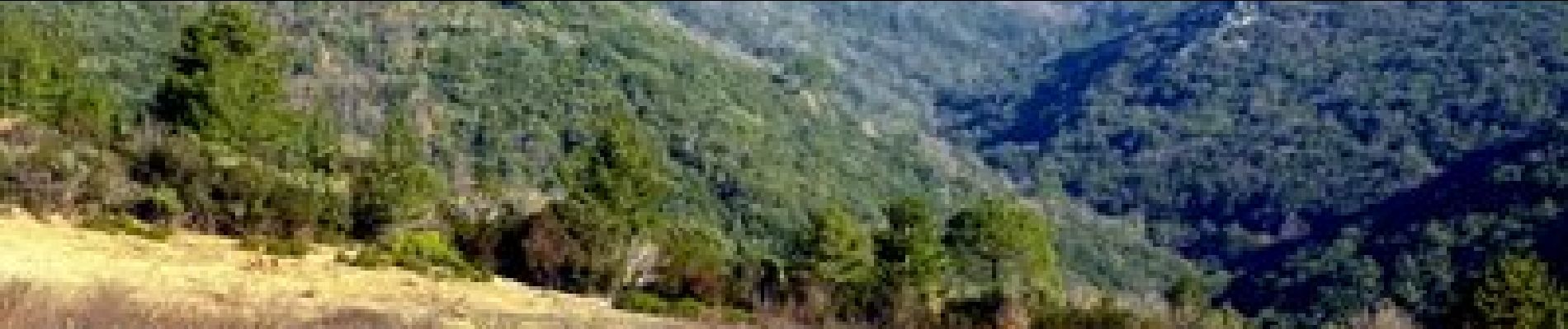
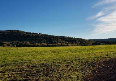
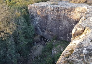
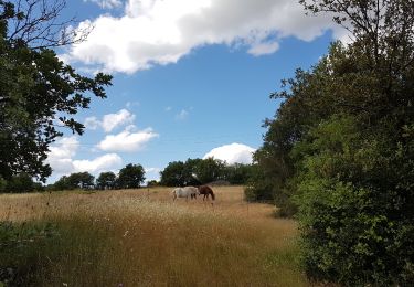
Le parcours depuis Le Bosc, point bas, et dans anti horaire paraît préférable notamment la lumière des photos. Intérêt : dolmens, blocs de granit, points de vue très large sur le Sud jusqu'à la mer, et, depuis le sommet du Brédou, sur les contreforts du Larzac au Nord.

Elevation profile

Photos

Points of interest

Point of interest Le Bosc - p9 - Photo
vertygo
LE BOSC 
Point of interest Le Bosc - p1 - Photo
vertygo
LE BOSC 
Point of interest Usclas-du-Bosc - p2 - Photo
vertygo
USCLAS-DU-BOSC 
Point of interest Saint-Privat - p3 - Photo
vertygo
SAINT-PRIVAT 
Point of interest Soumont - p4 - Photo
vertygo
SOUMONT 
Point of interest Le Bosc - p5 - Photo
vertygo
LE BOSC 
Point of interest Soumont - p6 - Photo
vertygo
SOUMONT 
Point of interest Soumont - p7 - Photo
vertygo
SOUMONT 
Point of interest Soumont - p8 - Photo
vertygo
SOUMONT 
Point of interest Le Bosc - p0 - Photo
vertygo
LE BOSC 

Positioning

Country:
France
Region :
Occitania
Department/Province :
Hérault
Municipality :
Le Bosc
Location:
Unknown
Start:(UTM)
530915 ; 4839826 (31T) N.

Comments

Please log in to post a review or rate the element


Trails nearby

Trail Walking Le Bosc - Saint-Alban - Célis - La Roque  - Photo
Walking
mdauzat

Walking

Medium
(1)
Le Bosc, Occitania, Hérault, France
5.7 km | 7.9 km-effort
1h 47min
Yes
Trail Nordic walking Celles - Les Vailhés Barrage du Salagou Mas Audran - Photo
Nordic walking
mdauzat

Nordic walking

Medium
(1)
Celles, Occitania, Hérault, France
14.4 km | 18.3 km-effort
3min
Yes
Trail Walking Soumont - Balcons de Soumont - Photo
Walking
mdauzat

Walking

Medium
(1)
Soumont, Occitania, Hérault, France
8.4 km | 11.9 km-effort
2h 29min
Yes
Trail Walking Celles - L'Auverne Salagou - Photo
Walking
mdauzat

Walking

Difficult
(1)
Celles, Occitania, Hérault, France
11.2 km | 14 km-effort
3h 10min
Yes
Trail Walking Soumont - Soumont et ses Dolmens - Photo
Walking
mrclic34

Walking

Medium
(3)
Soumont, Occitania, Hérault, France
18.2 km | 26 km-effort
5h 56min
Yes
Trail Walking Le Puech - Le Lac du Salagou - Photo
Walking
Cabaretou

Walking

Easy
(1)
Le Puech, Occitania, Hérault, France
10.1 km | 12.8 km-effort
4h 1min
Yes
Trail Walking Soumont - Les balcons de Soumont - Photo
Walking
daniel34

Walking

Medium
(2)
Soumont, Occitania, Hérault, France
12.5 km | 17.6 km-effort
5h 0min
Yes
Trail Walking Saint-Jean-de-la-Blaquière - Les Bois de Homs et de Latude - Photo
Walking
gerardhenr

Walking

Easy
(1)
Saint-Jean-de-la-Blaquière, Occitania, Hérault, France
9.3 km | 13.1 km-effort
2h 27min
Yes
Trail Walking Saint-Privat - Abbaye de Grandmont - Photo
Walking
guyzinz

Walking

Difficult
Saint-Privat, Occitania, Hérault, France
12.2 km | 17.2 km-effort
4h 12min
Yes


Close
My subscriptions